Stage by stand, monthly.
A monthly spectral read on bark beetle attack stage across your monitoring area, delivered as a register you can rank for salvage.
Specification
- GSD
- High, 0.5–2 m
- Cadence
- Monthly
- Platform
- High-res satellite
- Spectral
- Multispectral
- Unit
- One row per stand
- Stage classes
- Green-attackred-attackgrey-attack
- Formats
GeoPackage and CSV
Files in each monthly delivery
| No. | Deliverable | Format | What's in it | Cadence |
|---|---|---|---|---|
| F-01 | Stage-by-stand register | CSV | One row per stand in your monitoring area, with the stage class read that month and the date of the pass behind it. It opens in the spreadsheet or database the agency already keeps its stand records in. | Monthly |
| F-02 | Stage layer | GeoPackage | Your stand polygons carrying the same stage class, so the layer loads into the agency GIS and sits beside the aerial survey polygons. Stands are the ones you send us. | Monthly |
| F-03 | Stage-change flags | CSV | Stands that moved to a later stage since last month's pass, listed on their own. A stand that went from red to grey shows up here once a clear pass catches it, rather than waiting for the next flight. | Monthly |
| F-04 | Priority ranking | CSV | The stands ordered by stage for salvage scheduling. The ranking is by infestation stage only. Timber volume, access and haul distance stay with your sale planners. | Monthly |
| F-05 | Pass note | Text | The dates of the imagery and which parts of the area sat under cloud that month, so you know which stands are still on an older read. | Monthly |
How it works
01Input
Send your monitoring area
A boundary file and your stand polygons, in whatever your GIS exports. The stands you send are the units the register is written for.
02Process
Monthly pass
High-res multispectral imagery over the area, taken through the month when skies allow. Each stand is read for where it sits on the green, red and grey progression.
03Process
Compared to last month
Each stand's stage is compared with the previous pass, and a change to a later stage is flagged.
04Output
Delivery
The register, the stage layer, the flags, the priority ranking and the pass note, once a month for the period you agree.
Limits
| Condition | Effect on the output |
|---|---|
| Cloud and daylight | Imagery is optical. A cloudy month can push a stand's next usable pass to the following month, and the pass note says which stands are still on the older read. Winter light and snow cover leave fewer usable passes in northern forests. |
| Stand-level, not tree-level | At 0.5–2 m a single crown is barely resolved at the coarse end. The register stages a stand. It does not find individual infested trees. |
| Green-attack is the faint stage | Trees still green look much like healthy ones from above. The read is strongest once needles have turned, so early attack will often show up as red-attack first. |
| Stage from the spectrum | Stage is read from the spectral signature. It is not checked against ground survey unless you send plots or survey results to compare with. |
| Monthly, not continuous | Monthly is the target. It depends on clear passes, and there is no promise of a delivery day. |
| Current stage, not a forecast | The register reports what the imagery shows now. It does not predict where beetles will spread. |
Why this exists
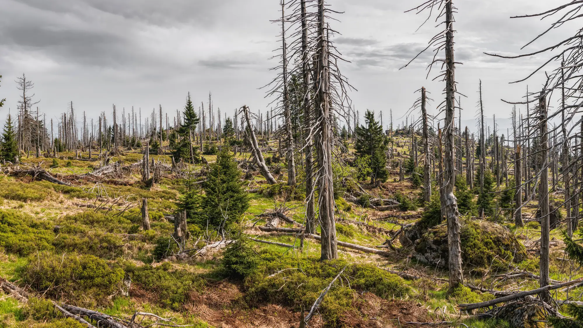
The aerial detection survey flies once in the season, and ground crews cover what roads and plots allow. By the time a salvage sale is being scheduled, the map is months old and stands have moved from red to grey. Grey-attack timber is worth less, so the stands that waited get passed over.
This gives you a monthly stage read on your stands, cloud permitting, between flights.
Who it's for
For
- Forest health specialists at a state or provincial agency who rank stands for salvage harvest.
- GIS staff who load a stage layer next to the aerial survey polygons.
Not for
- Finding single infested trees for removal.
- Forecasting where an outbreak will spread.
- Replacing the aerial detection survey or ground checks.
Questions from reviewers
Is this stand-level or tree-level?
Stand-level. It does not identify individual infested trees.
How is stage confirmed?
From the spectral signature of the pass. It is not cross-checked against ground survey unless you supply plots or results to compare with.
Can we check it against our own ground data?
Yes. Send plots or survey results for a few stands and we go through them with you against the register.
Does cloud cover change the monthly read?
Yes. A cloudy month can push a stand's next usable pass to the following month. The pass note lists which stands are on an older read.
Does it replace the aerial detection survey?
No. It sits between flights and gives a stage each month. The survey and ground checks stay yours.
Will it load into our GIS and stand records?
The stage layer is a GeoPackage and the register is a CSV. There is no direct integration with agency systems.
Who owns the data, and can we share it?
Your boundary and stands stay yours. What you can do with the files, and the licence on the imagery behind them, is written into the project agreement before the first delivery.
How is it priced?
It depends on the size of the monitoring area and how many months you want, so we quote after we have seen the area. There is no price list on this page.
Send us your monitoring area.
Send the boundary and your stands, plus the months you want covered. We scope the monthly run from there.